
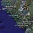
An environmental geography consultancy working with enviro and community orgs in Vancouver and the coastal region.
Remote sensing ecohydrological self-organization of southwestern vegetation. My major research for my master’s degree.
A Google Earth-compatible .kmz file with all the flightline locations for NASA’s AVIRIS hyperspectral sensor, from 2000 to 2006.
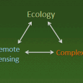
A manifesto for using remote sensing to power individual-based ecology, and a list of reasons why it would (will) be hard.
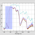
What’s the best way to measure water stress in Pinon and Juniper using hyperspectral sensing?