East Van is for Local Photographers (Maybe)
Eric Fischer used the locations of geotagged photos on Flickr to make a series of city maps he calls The Geotaggers’s World Atlas. Then he got even cleverer and figured out which of the photos came from locals and which came from tourists, based on the time lag in between photographs. The result is a new set of maps called Locals and Tourists.
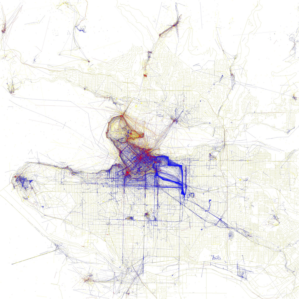
Red dots are photos from tourists, blue dots are from locals, and yellow are cases where Eric’s algorithm wasn’t able to conclusively differentiate. I notice two things.
- Vancouver is the 9th city on the list of 96. And according to Eric, he ordered them “by the number of pictures taken by locals”. So Vancouverites like to take photos of their city. (Although I suppose it depends on how big the other cities in the project were). Compare for instance with Las Vegas.
- Everything east of downtown belongs to the locals. Clark, Commercial, East Hastings, 2nd and for some reason Heatley are thick bands of solid blue.

crop
Except that I don’t entirely trust point #2. It just doesn’t make sense that Heatley would outshine Broadway as a go-to destination for photographers. Here’s what I think is happening: there aren’t actually that many people who go on blanket photo missions, then do the geeky work of linking their imagery output to GPS tracks and uploading them in bulk to flickr. Those few photomatic enthusiasts are driving the apparent patterns. That theory is anecdotally supported by this comment from Roland.
It’s a striking differential nonetheless. Next time I find myself visiting a new city, an interesting project would be to track down the places that the locals think are worthy of camera action, but don’t usually get much interest from foreign photogs.