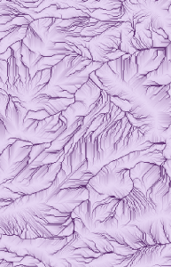
Modeled Flow Accumulations North of Strawberry Crater

Photos from Southwestern Research

2 months ago I was wandering around in rented cars, waking up to the dawn in improvised Forest Service campgrounds, cooking up bacon and eggs and coffee on camp stoves, breaking down my tent then rushing out into the piñon-juniper woodlands with a gps antenna magneted to my bandanna, a compass around my neck and a camera in my hand, documenting the landscapes that were going to become my study sites. I would drive and hike around in a rush to look at things until I decided I had to look at something in particular very slowly. Then I would stare at it. Mostly bushes and trees and soil and water courses. Also hills and valleys. I visited Sierra Vista and Tombstone and Arizona and Flagstaff and Cedar Ridge and Tuba City, and mostly places in between, like Cochise County and the San Pedro River and the Coconino forest and Waputki and the Little Colorado canyon and the rangelands of Navajo Nation. I took a train to New Mexico and did similar things there. Then I took a train home. It was a good time. There was a lot I missed because I was in a hurry to look at semi-arid vegetation, but there was a lot I saw because I was looking for semi-arid vegetation. I wrote about it a bit here.

Because I had a camera in my hand and because New Mexico and especially Arizona are so damn visual, I took a lot of photos. I’ve finally posted some of them up here.
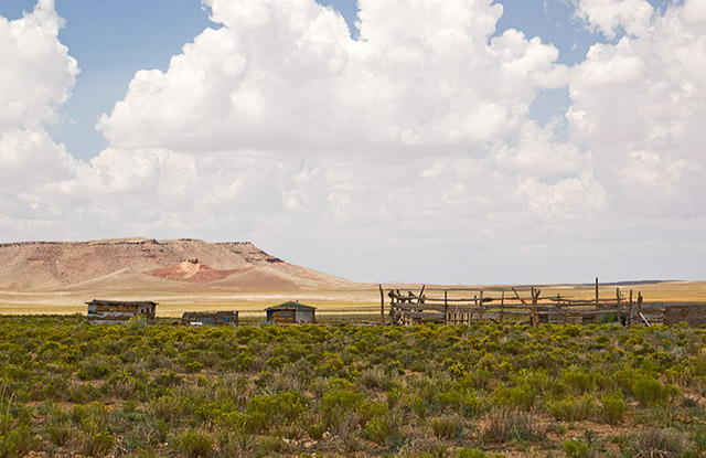
rental car in coconino rangeland

Windows on Earth

Windows on Earth is an interesting Google-Earth-like visualization program, apparently simulating the International Space Station’s view of the world in detail. A version of the project can be run through your web browser, no download.

The interface is kind of cool.

windows on earth interface

Apparently legendary video game designer Lord British is currently on the space station, and is using the program to help him take photographs of specific locations on earth, which will then be released, through the Windows on Earth program. Which all seems a bit meta. Interestingly, Lord British’s father is/was a NASA astronaut, and the photos being taken now will be for comparison with those taken by his father in the 70s and 80s, to visualize land cover change and human impact. Sounds like an interesting project.

GIS Art from the Drylands

I’m pleased to see that my research has started to produce some GIS art.

Below: Coconino Juniper Patches with Landscape Shape Index Overlay. Media: Patch Analyst on isodata classification of 1m orthoimagery.

Research Plan

For the curious, I’ve posted a more detailed version of my thesis research plan. Which is currently being executed.

Also, I’m nearly done developing some of my photos from my summer research trip, and that gallery will be up soon.

coconino forest from the high road

Google Earthing Cow Directions

Here’s a fun bit of Google Earth-utilizing research:

Magnetic alignment in grazing and resting cattle and deer, Begall et al, PNAS

“We demonstrate by means of simple, noninvasive methods (analysis of satellite images, field observations, and measuring “deer beds” in snow) that domestic cattle (n = 8,510 in 308 pastures) across the globe, and grazing and resting red and roe deer (n = 2,974 at 241 localities), align their body axes in roughly a north–south direction.”

Apparently this work follows on from previous research the team has done on the sensing of magnetic fields by naked mole rats. In this case, they used Google Earth to scroll around looking for cows, then once they had documented 8510 of them, decided they tend to lie down facing north-south. And likewise for deer.

Here’s some more
from NPR.

“Holland says that other researchers should confirm the finding. One way of doing that would be to “start going out and putting magnets on the heads of cows and horses and deer, to see how that affects them,” he says. “That’s one of the more traditional ways of testing if they have a magnetic sense.”

If they really do have an internal compass, he says, the magnet would mess it up.”

A Pareidoliac Quest for the Southwest

I’m back from my two-week ramble through the public lands of Arizona and New Mexico. This was an ideal destination for me: I’ve been in the area a few times before, just enough to begin to know what to seek out and what sorts of landscape patterns might be waiting for me, but not nearly enough for it not to seem entirely exotic and impossible to my boreal-based brain. Well, I’ve only now scratched the variations on landscape and vegetation and physiognomy of the great American southwest. But I did get to run down some old leads and spend some really solid time in a couple of regions I’ve long wanted to. And do so with the wonder of ignorance.

And oh yes, I was there to do some research reconnaissance. Looking to see what vegetation pattern looks like from side-on and roots-up instead of from above. I have a lot of digesting to do, but I suspect the trip was successful on that criterion. For sure I had great meetings with people who really do know the ecology of the magnificent semi-arid zones: Dave Breshears (who made time for me the day his right-hand-guy was leaving for a faculty position), Neil Cobb (who made time for me the week he was prepping for his wedding celebration) and Michaela Buenemann (who made time for me in between settling into her new faculty position and road tripping to Dr. Cobb’s wedding celebration). The reflexive generosity of time and ideas that researchers have for each other is one of the things I love about working in the sciences. It seems the best people are the ones who are the most giving of their resources. (Including data! Thanks guys. Thanks also to Dr. Alfredo Huete, whom I now really regret not having been organized enough to ask for a meeting with.)

Thanks also to this guy, whose website drove home the point that, unless it specifically says “no camping”, you can pretty much camp anywhere you want in the southwest. This turned out to be a key idea in my trip. There were a lot of places I wanted to camp, and did. And while I’m at it, thanks also to Enterprise, for not freaking out when I brought some rental cars back with a little dust in the wheel-wells.

Much of the point of being there was to take photos I could later reference while taking the remote-sensing god’s eye view of the same landscapes. So I had my camera in my hand a lot, and I’ll post some photos as I work through them.

Hunting for Pattern in the South West

I’m leaving today for 2 weeks of field work in Arizona and New Mexico.

I’m doing some field reconnaissance in support of my weird thesis research on self-organizing plant patterns in the semi-desert. That mostly means I’ll be driving around in rental cars, looking to see what the places I’ve been peering at from above actually look like in person. Also camping out in the high desert at night, looking to see what patterns the stars have. I’ll be in the Tucson/Sierra Vista region, then north of Flagstaff and up to the rim of the Canyon, then training into Santa Fe/Los Alamos area. I’m taking the Southwest Chief back to Chicago and Ann Arbor on the 23rd.

no pattern in central texas
Do you see a pattern? I don’t see a pattern.

Google Earth Index of AVIRIS Flightlines, 2000 to 2006

I’ve made a Google Earth-compatible .kmz file with all the AVIRIS flightline locations from 2000 to 2006, as listed on the AVIRIS website. Google Earth is a relatively painless and speedy way to get a sense of the landscape sensed in each imagery dataset.

More information and the file itself is available on this page.

(AVIRIS is NASA’s plane-mounted hyperspectral sensor. It is entirely a coincidence that I’m posting this on NASA’s 50th birthday but hey, happy birthday NASA.)

NASA: 50 Years of Figuring Out What They Do

The National Aeronautics and Space Administration was signed into existence 50 years ago today. The Economist has a good, reasonably breif, article about the intentions and directions of the agency. Being the Economist, it’s partially speculation about potential private-industry virtues of “space exploration”. But the article is more about the division between the dreams of the manned and unmanned branches of the agency. It also mentions the earth-observing program, which I think is a third NASA branch unto itself. The article suggests the unmanned probe makers may tolerate the manned exploration romantics just as cover and funding-bait. And possibly vice a versa. Maybe the earth-observers can likewise use both the manned and the unmanned missions as an infrastructure to exploit. Either dream is closer to the original mandate of the massive NASA bureaucracy than building satellites to measure the environment, which could be a hard sell on it’s own. Or maybe, nowadays, astronauts and probes both just draw away money and steam it off into space.

Many happy returns? — The Economist

Also see A Rocket to Nowhere, from a few years back.

← newer posts · older posts →