Some projects cross-posted at hughstimson.com.

An environmental geography consultancy working with enviro and community orgs in Vancouver and the coastal region.
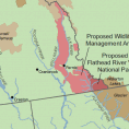
Assembling data and composing maps for a David Suzuki Foundation report on species and habitats which span political jurisdictions.
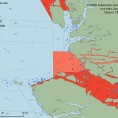
Developing data management and an analysis framework for a Canadian Wildlife Service study of seabird bycatch in the salmon gillnet fishery.
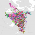
Importing 25 years of Caribou migration data into Google Earth format, time-linking it and smoothing it for animation.
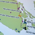
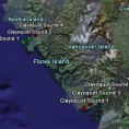
A reference map to intuitively convey compiled information about jurisdiction and location of First Nations Family and Child Services on Vancouver Island.
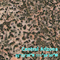
Remote sensing ecohydrological self-organization of southwestern vegetation. My major research for my master’s degree.
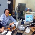
WCBN’s environmental talk show. Noon to 1pm alternate Mondays on the FM, streaming and podcast. Listen to the actual sound of environmentalists.
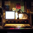
My music show on WCBN, 2006 to 2008. By many names, but principally as dj Hugonaut.
A Google Earth-compatible .kmz file with all the flightline locations for NASA’s AVIRIS hyperspectral sensor, from 2000 to 2006.
In the summer of 2008 I was in Creston BC for a treeplanting contract. CIDO 97.7 let me do a treeplanting-themed radio show.
Exploring the space/time synchronization of fruit-eating vertebrates with fruiting trees and of fruiting trees with climate signals
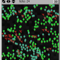
Demonstrating use of a spatial clustering statistic in the agent-based modeling environment.
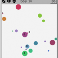
Trying to recreate accent formation and spatial shifting patterns using some basic mechanisms and emergence.
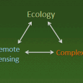
A manifesto for using remote sensing to power individual-based ecology, and a list of reasons why it would (will) be hard.
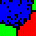
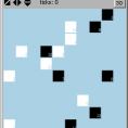
What if the classic Schelling segregation model included children born of the “reds” and the “blues”?
A website for one of the last of the old-time freenets, “providing non-profit computer and internet tools for personal and community development”.
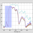
What’s the best way to measure water stress in Pinon and Juniper using hyperspectral sensing?
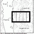
Testing Grime & Connell’s classic diversity hypothesis at an unusually small spatial scale.