Richmond Is Really Lulu Island

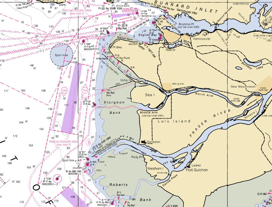
While visiting a friend who lives on a boat, I noticed that on her nautical charts Richmond was labelled an island. Which I suppose it is. And that furthermore that island isn’t called “Richmond”. It’s actually called Lulu Island.

That’s a great name, but where does it come from? I checked the internet, and the consensus seems to be that Lulu Island was named in the 1860s, after a women named Lulu Sweet.

So who was Lulu Sweet? Not so clear. Here’s Wikipedia’s take:

“Lulu Island was named in 1862 for Lulu Sweet, a popular showgirl, possibly of Kanaka (Hawaiian) origin, who was dating the mayor of New Westminster when the island was named (she had bought property there).”

It’s always about real estate in Vancouver, even when it’s about showgirls. The BC Geographic Names Information System records a few similar-but-different theories about Lulu. Was she indeed a showgirl in the first troupe to visit New West?

“Named in 1862 by Colonel Moody, RE, in command of a detachment of the Royal Engineers then stationed at New Westminster, after Lulu Sweet, a young actress travelling with the first theatrical troupe that ever acted in that city. ‘Her conduct, acting and graceful manners gave great satisfaction, and were appreciated to such an extent by her friends and patrons that the island was named after her.'”

or was she actually in the employ of the Hudson’s Bay company?

“As reported in the 1897 British Columbia Year Book, Lulu was a Hawaiian or Kanaka, in the employ of the Hudson’s Bay Company. […. At times over the next years the majority of Fort Langley employees were of Hawaiian descent, but HBC archives don’t describe any incident or occasion that would warrant such a gesture.]”

Colonel Richard Moody was not, as the Wikipedia article is perhaps implying, the first mayor of New Westminster. He was a Royal Engineer and one of BC’s first Lieutenant Governors, back when that meant something. He also picked the site for New West, because he wanted to make it the province’s first official capital. (The first unofficial capital was Langley. Apparently the early British Columbians had poor taste in capitals.) According to the correspondence of his personal secretary, Moody was responsible for out-maneuvering the regional representative of the Hudson’s Bay Company. He also had a wife and 7 kids, so it would be interesting if he was spending a lot of time hanging around with a Hawaiian women in the employ of the HBC.

The Vancouver History website has some details which support the showgirl theory, pegs her at 16 years old at the time of the naming, and suggests Moody and Sweet may only have known each other in passing.

“On January 10, 1861 (a date of January 12, 1860 is also cited), during a tour of local waters, the commander of the Engineers, Col. Richard Moody, was showing Miss Sweet various features of the landscape. As they passed one island in the Fraser, she asked its name. “It has no name as yet,” Col. Moody responded, “but in tribute to you we shall call it Lulu Island.”

Unfortunately, they don’t cite their sources. Nor does this Richmond art project’s site, which carries on the water-tour narrative, and furthermore claims that Lulu was from San Francisco (not Hawaii?), revered by the newspapers for being chaste and beautiful, and that Moody was “one of her most ardent admirers”.

I happen to be a fan of the original name of North Vancouver: Moodyville. It wasn’t named after Col. Moody but we can pretend it was. Then we can resurrect the true names of both North Van and Richmond, and the ardent admirers can gaze across Vancouver at each other.
East Van is for Local Photographers (Maybe)

Eric Fischer used the locations of geotagged photos on Flickr to make a series of city maps he calls The Geotaggers’s World Atlas. Then he got even cleverer and figured out which of the photos came from locals and which came from tourists, based on the time lag in between photographs. The result is a new set of maps called Locals and Tourists.

Here’s Vancouver:

Red dots are photos from tourists, blue dots are from locals, and yellow are cases where Eric’s algorithm wasn’t able to conclusively differentiate. I notice two things.

  1. Vancouver is the 9th city on the list of 96. And according to Eric, he ordered them “by the number of pictures taken by locals”. So Vancouverites like to take photos of their city. (Although I suppose it depends on how big the other cities in the project were). Compare for instance with Las Vegas.
  2. Everything east of downtown belongs to the locals. Clark, Commercial, East Hastings, 2nd and for some reason Heatley are thick bands of solid blue.

crop

Except that I don’t entirely trust point #2. It just doesn’t make sense that Heatley would outshine Broadway as a go-to destination for photographers. Here’s what I think is happening: there aren’t actually that many people who go on blanket photo missions, then do the geeky work of linking their imagery output to GPS tracks and uploading them in bulk to flickr. Those few photomatic enthusiasts are driving the apparent patterns. That theory is anecdotally supported by this comment from Roland.

It’s a striking differential nonetheless. Next time I find myself visiting a new city, an interesting project would be to track down the places that the locals think are worthy of camera action, but don’t usually get much interest from foreign photogs.

Treeplanting Video Past & Present

I don’t know how I didn’t know about Do It With Joy, a 1976 documentary about one of the first treeplanting crews working out of a hand-hewn camp up the Nass Valley, organized by Dirk Brinkman in a giant beard, and featuring some kick-ass mattock and blues:

The film was made by Nicholas and Simon Kendall, among others. It’s a gold mine of imagery from the foundational era of treeplanting, and beautifully bearded.

“Everytime I meet someone who’s really messed up in their head, I often think wow, what that person needs is to go treeplanting, that would be a really nice gift for them.”

Pauline Kendall
(who I think hauled a load of compost from our overstock pile a while back)

correction: Glada McIntyre (thanks Carole)

An updated version, with where-are-they-now interviews (and hopefully better quality) might be available from Orca Productions. If it is, we’ll be holding a viewing at the house sometime soon.

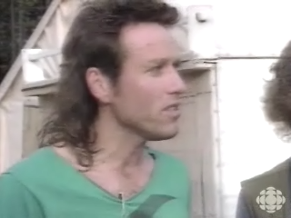
Here’s a 1987 CBC report, which catches up with Dirk Brinkman, who has swapped his beard for Bill Gates glasses and is tapping away at an Apple IIe, trying to figure out how to increase treeplanting production to meet the growing late 80’s demand. If he only knew I would arrive 13 years later, he wouldn’t be so stressed. It also features this haircut:

“Back in British Columbia, in the hills southwest of Vanderhouf, blackflies and mutiny fill the air”

And 35 years after we started, here’s a prime example of the recent surge in digital-facilitated planter-made clearcut reportage: Faces and Hands, a series of short vids by Millefiore Clarkes being distributed by Peppermill Records. The episodes will show up weekly on the Peppermill site. Here’s episode one:

Back from Treeplanting

My treeplanting contract, being just a very small one, has ended. I am back in Vancouver and happy to be here.

Our planting crew, being just a very small one, is pictured below. Thanks to Mike Cawley for the picture. Absent from the photo are Mike and our rookie Drew.

Cypress Consulting treeplanting crew photo, May 2010.
Deva, Peter, Marie-Christine, Me (below), Rich (above), Andrew, shovel.

That’s me modeling a pilsner, energy drink of choice in the Northlands.

As anticipated, it was indeed as close to coastal planting as I’ve come. Most of the crew were coastal vets, according to them the cutblocks weren’t much different from what could be found around, say, Bute Inlet. Although they also pointed out that the extremes of slope and slash size weren’t as extreme as true coastal extremities, and that the rain was coming in from above rather than from sideways. Which is fine. Close to coastal style planting is as close as I ever want to come.

The buddhists say that self-awareness allows you to suffer and yet not truly suffer. That occurred to me once or twice when I was working through the worst of what was indeed pretty bad land, and finding myself mentally in reasonably good shape. I guess there is some benefit to being a planting vet, namely that you can get through more treeplanting with equanimity intact. I wish I could say the same of my shins.

Tree prices were high, crew and company were good, and camping out on the Dinwoodie homestead was fun. My back feels a little funny, but I’ve got some more jingle in my pocket and I’m home in the city. And I get to swagger around here pretending to be a treeplanter back from a contract. Two weeks of slash climbing is a reasonable price to pay for these privileges.

A Few Treeplanting Photos

I’ve posted a few photos from my current little treeplanting contract. One more shift to go.


forgive the cliche

They’re Pretty Quick As A Matter of Fact

I’m pleased to see that a second member of the 60’s rock outfit The Chob has now commented on my post celebrating the lyrics of their song We’re Pretty Quick.

“Amazing to keep finding posts about We’re pretty Quick after all these years. Funny that none of them has gotten the lyrics exactly right yet.”

Okay, so maybe I was celebrating the wrong lyrics. I still like them.

Once More Unto the Bush, Dear Friends, Once More

Every year, at the end of the treeplanting season, I tell everyone I might be coming back again next year. And every year I know in my heart that no, that really was my last contract.

Maybe I’ll feel the same way at the end of this season, because off I go again.

The last couple of years were short seasons for me, but this year it’s going to be really short. 2 to 3 shifts, as part of a six-planter contract working out the back of somebody’s house in Rosswood, north of Terrace. Nothing like the 90 day, multi-company seasons of yore.


View Larger Map

This will be the the closest I’ve come to coastal planting, which I foreswore many years ago as a pass-time for crazies. But I’m told the land isn’t too bad, the blocks aren’t too steep, the views are good and it’s 28 cents for straight plant. I’ll find out soon enough, for better or worse. Two summers ago my knees started to go, and last year I got tendinitis for the first time. What fresh wonders of terrain and physical decay are in store for me this year? Surely nothing can go too badly in two shifts. I could stand on my head for two shifts if I had too.

And then I’ll be back! And looking for summer-time fun and grownup work in the grand old city of Vancouver.


British Columbia, where the blocks are as steep as the prices

Previously:

Massive Risk Management

Governor Schwarzenegger made an announcement on Monday. He’s withdrawing support for a planned offshore oil project in California state waters. He was very clear: this decision was made specifically because of the Gulf oil leaks.

“I think that we all go through the endless amount of studies and research and everything, and before you make a decision like that, you are convinced that this will be safe,” the governor added. “But then again, you know, you see that, you turn on television and see this enormous disaster and you say to yourself, why would we want to take that risk?”

We have a hard time planning around risks that have low probability but potentially massive impact. Most risk assessment is done intuitively, and our intuition gets fickle around long-tail events. Our gut instincts differ person-to-person, and also perhaps within ourselves. Somehow I can never be bothered to wear a helmet when I get on a bicycle, but when riding a motorcycle in states without a helmet requirement, the idea of taking mine off strikes me as absolutely insane.

Formal cost-benefit analyses can be used to mathematize planning around uncertain outcomes, and they often are. But CBA can lead to especially extreme cases of garbage-in/garbage-out, and usually does. What number do you assign to the “cost” of a species loss, for example. And how would an equation help if you didn’t know what the probability of a species loss was anyway? Laplaces’s insufficient reason criterion can be used to hold together these shaky formalizations, but that criterion states that if you can’t guess the outcome, insert a 50/50 chance of it happening. Which makes intuitive sense I guess, but here we are at intuition again.

Intuition is sensitive to recent circumstances. And so, because of the timing of the “pictures on TV”, California won’t have offshore drilling. I’m sympathetic to the governor; I’m sure he was shown credible evidence that safety standards in oil rigging have been much improved. But how much safety is enough? It depends what’s on TV at the moment.

We seem to collectively deal with a lot of these low-probability/high-impact decisions. I think they’re some of the most important choices societies make (whatever that means). For example, the question “how to deal with the threat of terrorism?”, is premised, often invisibly, on the question “how much of a threat is terrorism?”. Is the attempted Times Square bombing proof that Americans are living under threat? Or is it a reminder that American citizens are remarkably safe from home front terrorism? When the potential consequences are so important, declaring something irrelevant because it’s out-of-the-ordinary doesn’t seem right somehow. And yet, and yet.

Or how about that crazy climate change? Critics suggest that because we have uncertainty in the outcomes — which we absolutely do — we shouldn’t be pouring resources into combatting an unknown. Which isn’t so crazy, if you consider the opportunity costs: the money and time and political capital we spend keeping carbon out of the atmosphere could be going to plenty of other deserving projects. But my intuition tells me that the uncertainty associated with climate change is precisely the reason we should fear it. I worry that we’re going to learn too late the value of a predictable climate. Each specific climate-linked tragedy may be unlikely to the point of absolute unknowability, but somehow that collection of unknowable tragedies sounds like the worst thing in the world to me.

I have a hard time articulating that threat to myself or to others, but the precautionary principle speaks to it. According to wikipedia, the principle states that

“if an action or policy has a suspected risk of causing harm to the public or to the environment, in the absence of scientific consensus that the action or policy is harmful, the burden of proof that it is not harmful falls on those who advocate taking the action.”

Environmental systems are weird. They often seem to be complex in the academic sense, behaving in aggregate in ways which can be either resistant to perturbation or suddenly highly sensistive to it. Formal complex systems theory usually isn’t very good at predicting outcomes in environmental systems (although I think it’s fabulous at helping us to understand why we can’t make those predictions). Ecologies are weird and unknowable, but they are also crucial to our lives, both in big ways and small ways. We will all die if the ecosystem services we rely on are thrown out of wack, but we will all be miserable and grumpy long before those services completely collapse. That combination of complexity and cruciality makes predictions around unlikely but potentially significant environmental dangers especially perplexing.

I’m not usually a small-c conservative, I tend to value experimentation and liberal politics. But because of the particularly fraught nature of environmental choices, I’m a big believer in that precautionary principle.

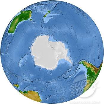
A Vegetation Map of the Antarctic

The actual title is “A Vegetation Map of the Southern Hemisphere”. For sale here. Nice palette, but not the projection I would have chosen.

Google Maps With ‘Earth View’ Still Has ‘Terrain View’

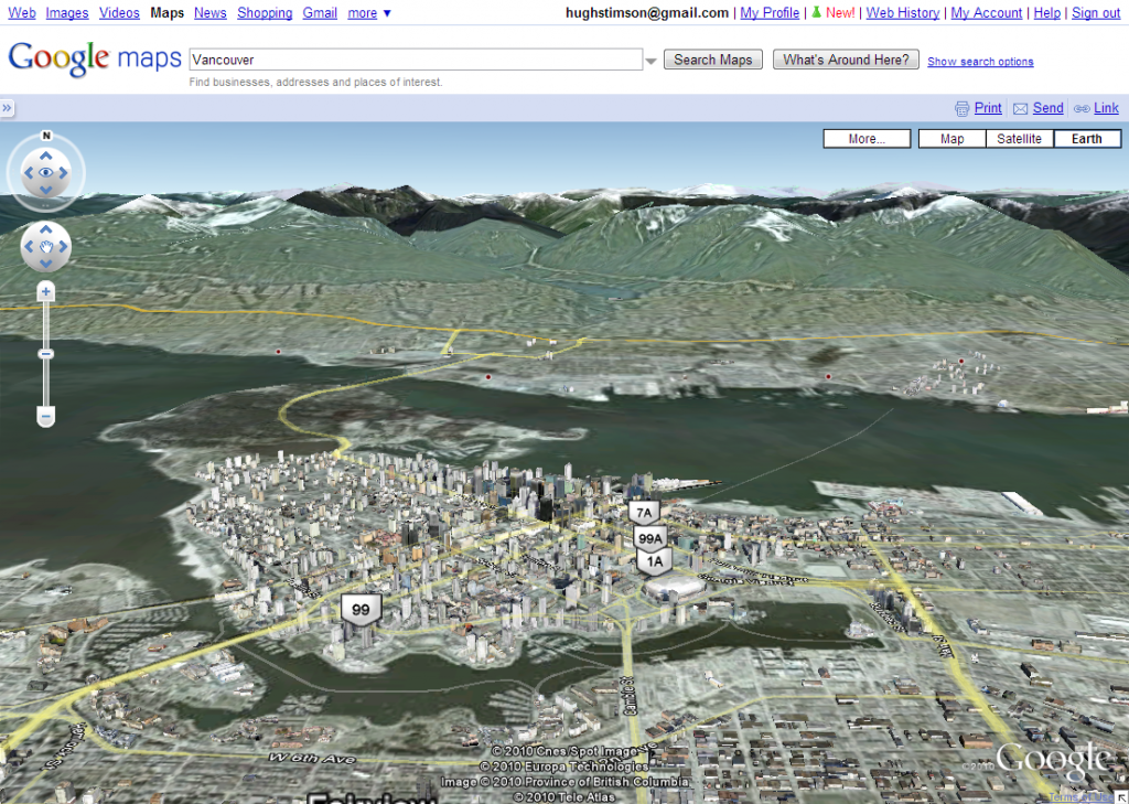
Google has just integrated the 3-D fly-through technology of Google Earth into their standard Google Maps website. How do they pack the tech of a 70mb program into a utility that runs in a browser? I do not know, although it appears they may have just (“just”) made the Google Earth plugin for web browsers into an automatic download and install.

Vancouver in its 3-dimensional glory

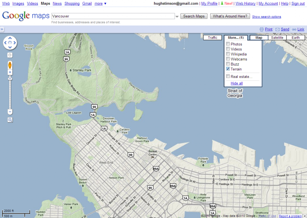
I was concerned that the arrival of Earth view had replaced the ‘terrain’ view option. Among other things, the hillshaded terrain view is handy for grabbing lat/long locations of natural features for quick input into GIS, particularly when used in conjunction with the LatLng marker option.

But all is well. ‘Terrain’ view is still there, it’s just been moved into the ‘More’ dropdown menu.

decent terrain, too

newer posts · older posts